


Lac vert et lac du Forlet

PhilippeC54
User

Length
18 km

Max alt
1300 m

Uphill gradient
738 m
Km-Effort
28 km

Min alt
1049 m

Downhill gradient
733 m
Boucle
Yes
Creation date :
2025-05-01 08:11:14.697
Updated on :
2025-05-01 15:37:45.67
7h25
Difficulty : Difficult

FREE GPS app for hiking
 SityTrail
IGN / Geographical institutes
SityTrail Plus
The world is yours!
About
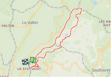
Trail Walking of 18 km to be discovered at Grand Est, Vosges, Le Valtin. This trail is proposed by PhilippeC54.
Positioning
Country:
France
Region :
Grand Est
Department/Province :
Vosges
Municipality :
Le Valtin
Location:
Unknown
Start:(Dec)
Start:(UTM)
352661 ; 5325423 (32U) N.
Comments